Umwelt Leading The Way
Playzilla AU casino
Playzilla Casino shines as a top choice in the online casino world, particularly appealing to Australian players. It boasts a vast selection of games, ranging from thrilling slots to various table games and immersive live dealer experiences, catering to all kinds of gaming tastes. Seamlessly blending into its appeal is the casino's user-friendly interface, making navigation and game choice effortless for both new and experienced players. Playzilla also stands out for its generous bonus offers and promotions, providing players with more chances to play and win, alongside regular tournaments and loyalty rewards that keep the excitement high. For an in-depth understanding of what Playzilla offers, especially tailored for Australian gamers, a visit to https://casinoau10.com/playzilla/ is highly recommended. This comprehensive review covers all aspects, from game variety to security measures, ensuring players have all the information they need to enjoy a top-notch gaming experience.
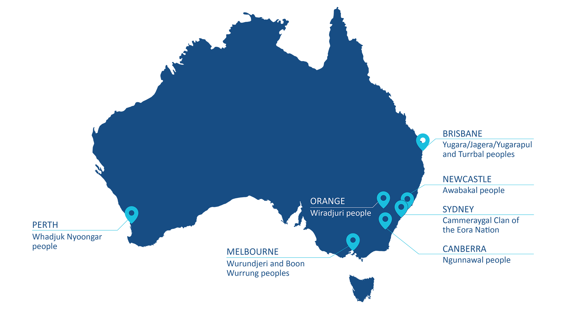
Umwelt has been assisting private and public sector clients realise superior outcomes for communities and the environment – resulting in a more sustainable future for us all.
We are a large multi-disciplinary team of social and environmental scientists who assess, mitigate and enhance the impacts of development across resources, renewables, infrastructure, defence and urban planning sectors.
For industry, we save time and money by reducing project risks and improving project acceptability.
For government, we make thoughtful contributions to policy making, participating on various advisory panels at local, state, and federal levels.
At the community level, we ensure stakeholders have a voice in the decisions that affect them, assuring that social impacts are identified and managed effectively to improve social and community outcomes.
Our remarkable professional cohort includes recognised leaders in their fields, with high level accreditations that allow almost every social and environmental aspect of development to be supported.
We are passionate about what we do and are driven to make a difference with sustainable, equitable and successful outcomes for our environment, our communities, and our clients.
Learn More